Upcoming events
No events currently scheduled.
Contact us for more information or join our mailing list to stay up to date on future events.
About the workshop
This workshop focuses on applying QGIS to explore, analyse, and visualise geochemistry and geophysics data for mineral exploration and environmental assessments.
Designed for participants with a working knowledge of QGIS, the session dives into practical workflows for integrating and interpreting geoscientific datasets, turning raw data into clear, spatially meaningful outputs.
What we'll cover
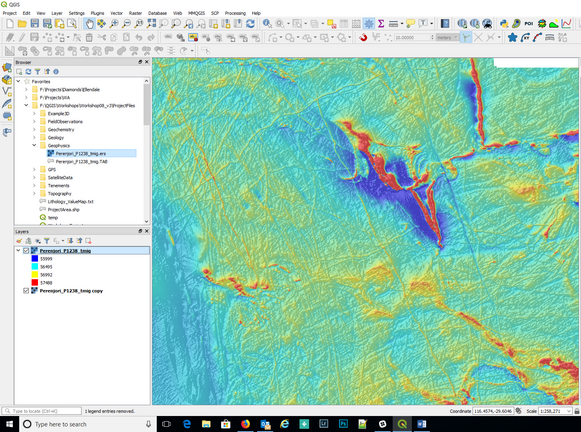
We'll work through applied examples using real-world data, covering:
- Preparing and importing geochemical and geophysical datasets
- Creating interpolated surfaces and contour maps
- Styling and visualising multi-parameter datasets for interpretation
- Integrating geoscientific data with geological maps, satellite imagery, and other spatial layers
- Using QGIS tools to import and grid located geophysical data
Who should attend
Geoscientists, including geologists, geochemists, and geophysicists, who already use QGIS and want to expand their capabilities in working with subsurface and surface data for exploration, mapping, or environmental monitoring.
Certification
Mammoth Geospatial is an accredited QGIS Certifying Organisation. Workshop participants have the option of receiving an official QGIS certificate on completion, which provides a mechanism to financially support the QGIS project.
Additional Information
What to bring
- A laptop with a recent version of QGIS (>= 3.40)
- A mouse with a scroll wheel is highly recommended
We'll provide more information about QGIS versions and other requirements when you register.
Class size
Maximum 16 participants.
Cancellation Policy
You can cancel your registration up to 7 days before the workshop, subject to a 10% processing fee to cover non-refundable ticketing platform fees.
Unfortunately, we're unable to offer cancellations or refunds after that point.
AIG members
AIG members are eligible for a discounted registration and CPD points.