AgTwin: Digital twin for agriculture
Agronomeye
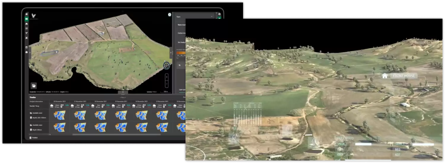
Agronomeye's AgTwin is a groundbreaking 3D digital twin platform for farmers to drive decision making and planning.
We support the Agronomeye team with strategic geospatial support, workflow planning, and data capture.
- QGIS & QGIS plugin development
- PostGIS
- GDAL
Over the years, we've developed a strong partnership with Agronomeye, collaborating to build a systematic workflow to meet their complex data capture needs with seed, precision, and attention to detail. Our support includes elevation model processing, hydrological modelling, and the design and implementation of PostGIS databases.
Our team uses QGIS workflows, custom-built QGIS templates with embedded validation, and automation through QGIS plugins and PyQGIS scripts to help Agronomeye deliver highly accurate datasets of farm assets. This strategic GIS support ensures that AgTwin's digital twin platform is backed by reliable, high-quality geospatial data for impactful agricultural insights.
Some of the features we've built to enhance the process:
- Validated Data Capture Workflows: QGIS templates with built-in validation
- Automated Geospatial Processing: PyQGIS scripts to automate data processing and validation
- Advanced Imagery and DEM Processing: Bash/Python/GDAL scripts for imagery & DEM processing
- PostGIS Workflow Integration: PostGIS workflows for storing and managing complex geospatial data,
As Agronomeye continues to reshape agriculture with their cutting-edge platform, we're excited to contribute to their journey.