AgTwin: Digital twin for agriculture
Agronomeye
Agronomeye's AgTwin is a groundbreaking new 3D digital twin platform for farmers to drive decision making and planning.
We're supporting the Agronomeye team with strategic geospatial support, workflow planning, and data capture.
- QGIS & QGIS plugin development
- PostGIS
- GDAL
Over the past several years, we've cultivated a strong partnership with the Agronomeye team, playing a crucial role in supporting the development of their revolutionary digital twin platform for agriculture.
We've worked to craft a systematic workflow that caters to their data capture needs. Precision, attention to detail, and speed are our guiding principles.
Some of the features we've built to enhance the process include:
- Bespoke QGIS templates with built-in validation.
- Specialised QGIS validation processing tools.
- Data extraction mechanisms designed for Agronomeye's unique processing requirements.
- Documentation to support the workflow.
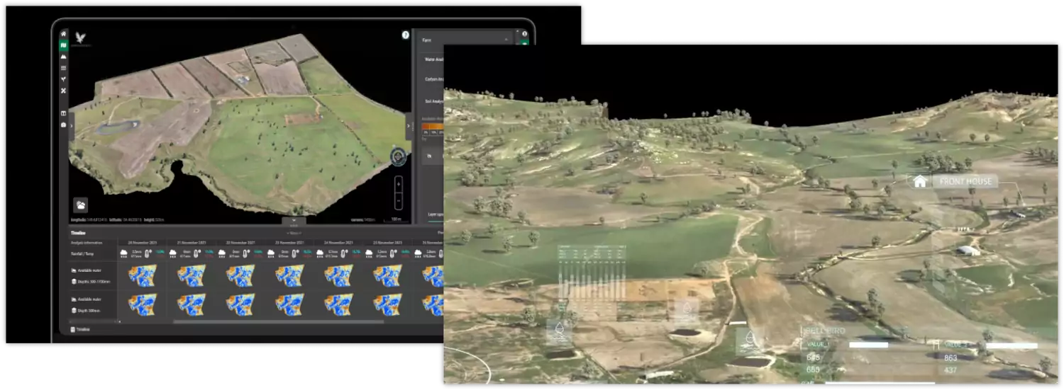
Each asset is mapped by our team of experienced digitisers to capture the digital transformation of farm assets. From processing data imagery to creating scripted processes to streamline the data capture process, we're dedicated to ensuring the quality of our service.
As Agronomeye continues to reshape agriculture with their cutting-edge platform, we're excited to contribute to their journey.